
 For some reason, I’m one of those people that has an unusual interest in maps and tourism information. Hmmm?
Over 10 years ago, I got this map from the Sigüenza Tourism Office when they first opened in the refurbished Ermita del Humilladero. Besides some rudimentary rack cards from some local businesses, this was the extent of the tourism information that was available. Could it be that those were pre-Google days? Gads. Along with this map, here are the tools you will need to plan a trip to Sigüenza.
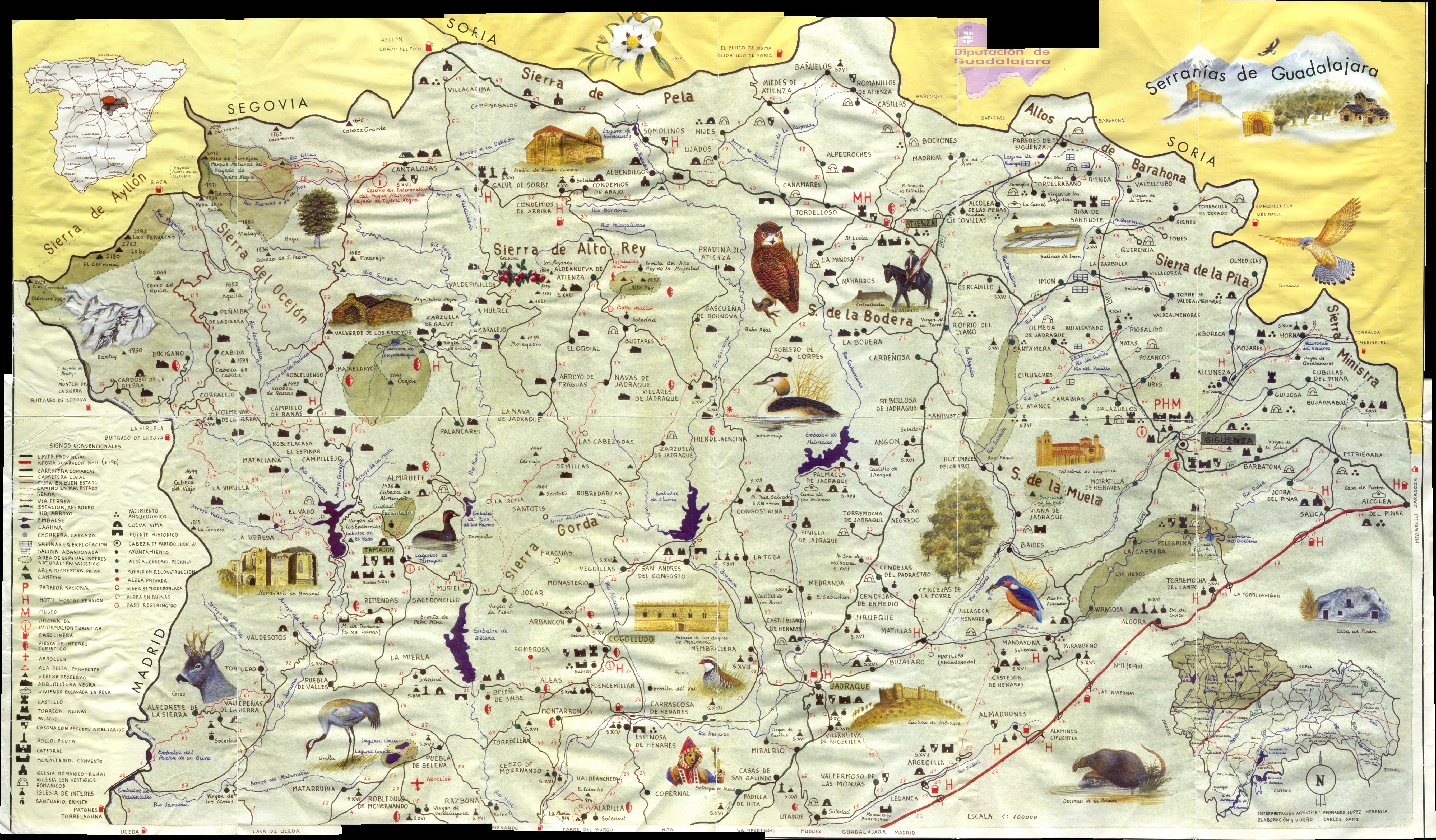
As you might guess, this map is quite used. For good reason. All the other maps available at the time were poorly detailed road maps – pretty inadequate for biking information. But, this map filled the huge gap. It’s no longer in print and now is replaced by a colorful and barely useful “romance” version. I hate romance maps. Download the scan of one of the last remaining copies.
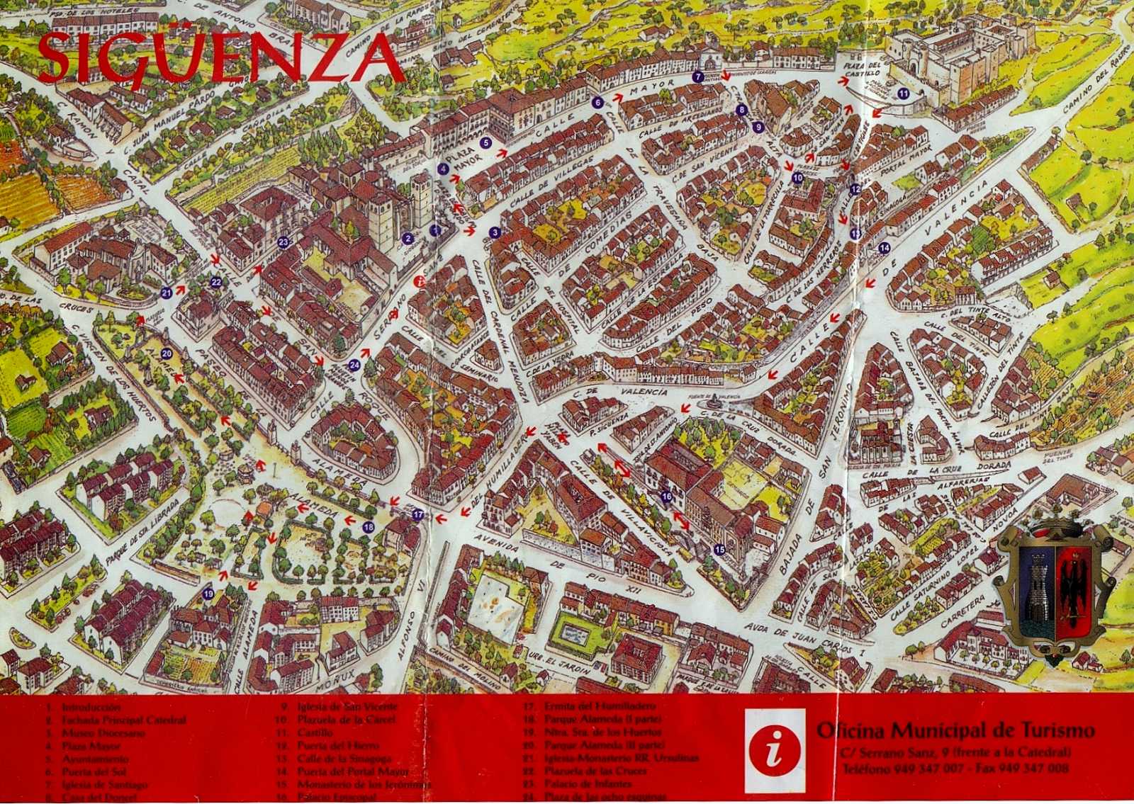
Tours of the “Medieval City of the Doncel” are given by the tourism folks, on demand-during the week and off-season, massive groups with amplified speakers on weekends. You can buy a small printed area map with a mini-map of the city (I think Pueblo is more accurate), but it is pretty vanilla. I like the old version, it’s a little more fun to look at. Here’s one I found in the back of a drawer.
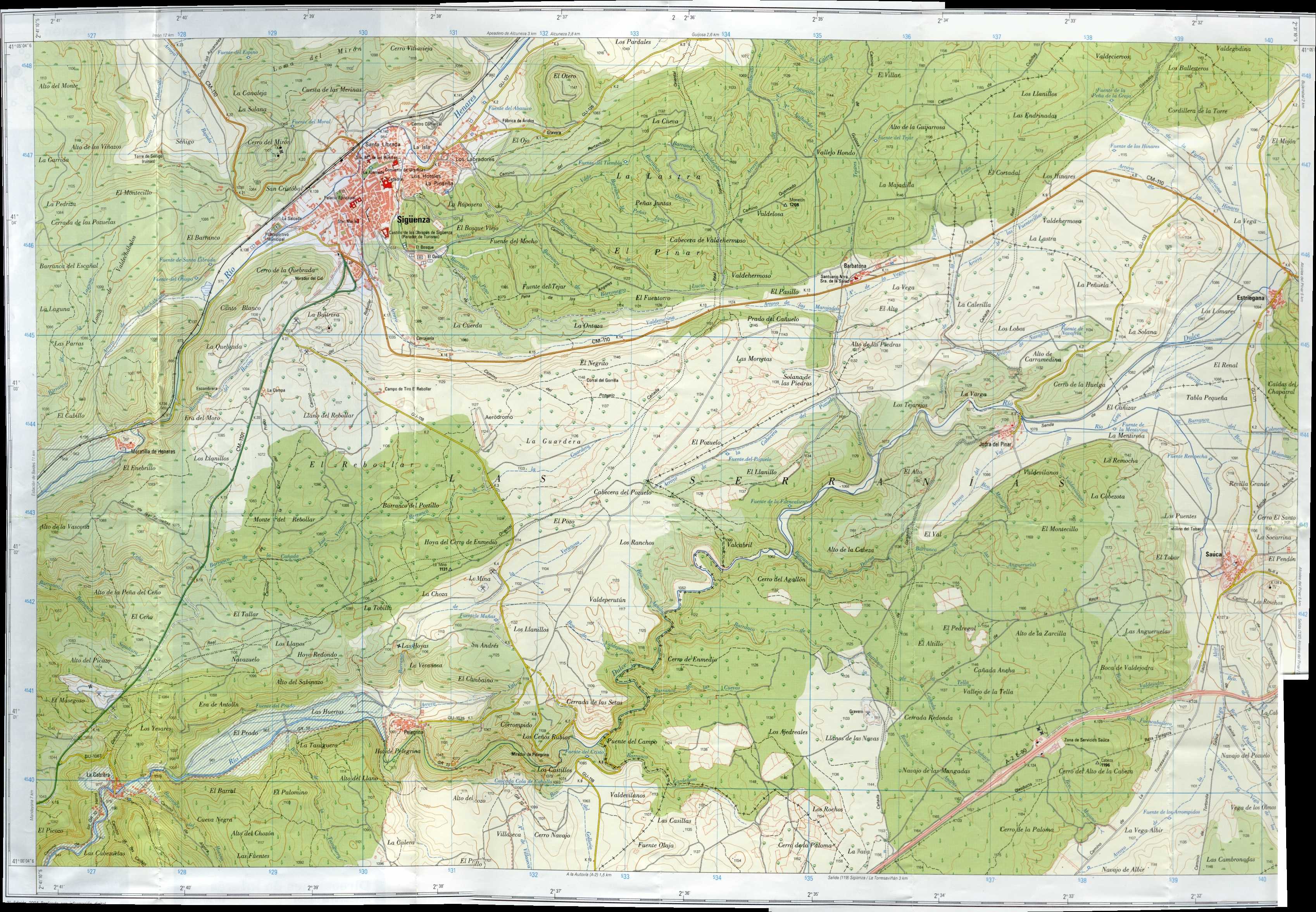
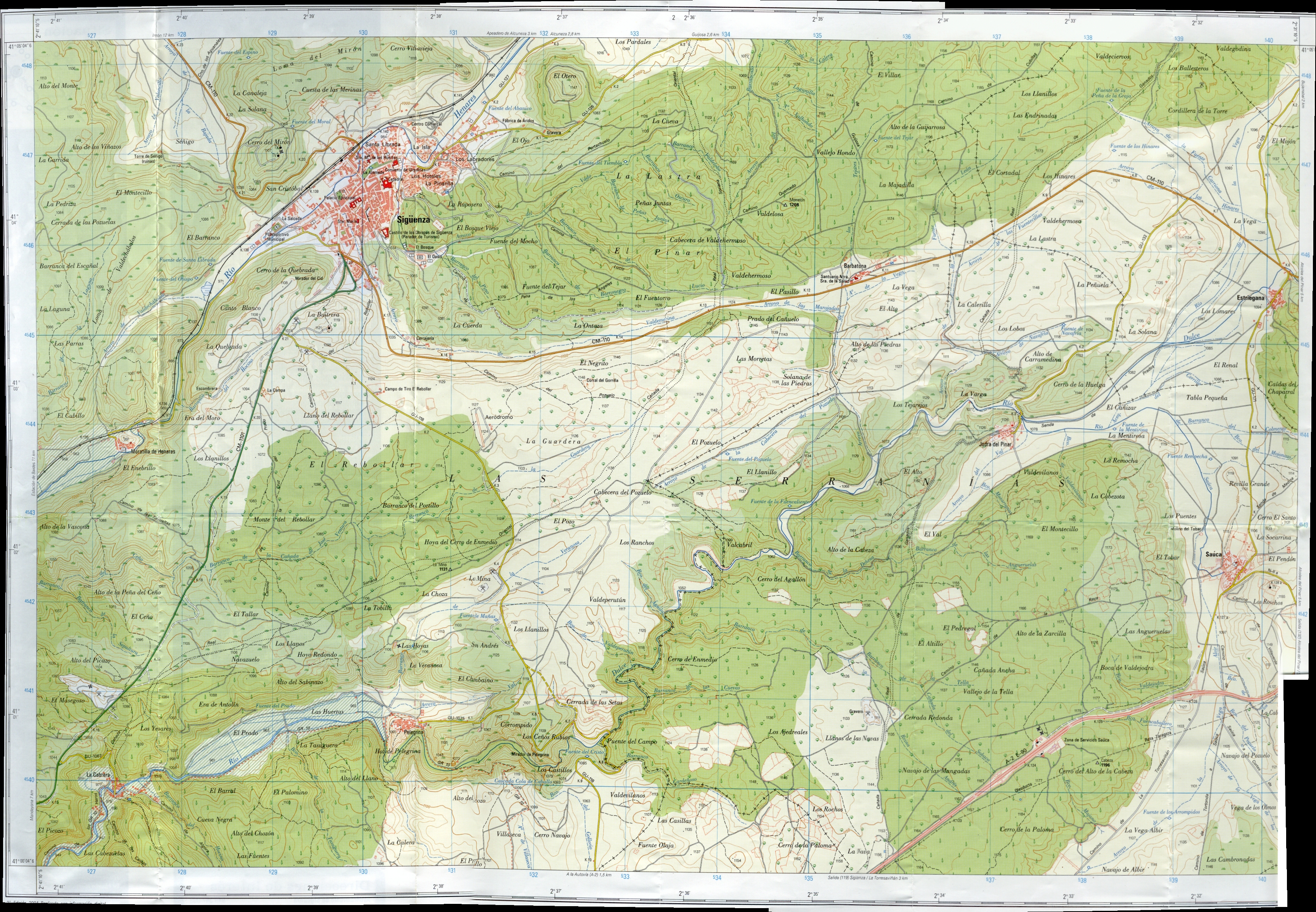
Incredibly, this year we also found some free topographic maps. Got one that covered the area to the south of Sigüenza, including the Parque Natural del Barranco Río Dulce.
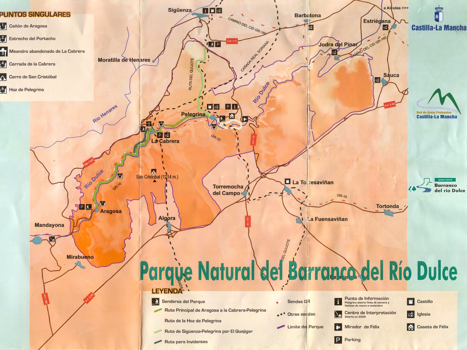
Nearby Sigüenza is the Río Dulce watershed. Beautiful terrain and now protected as the above mentioned Parque Natural del Barranco Río Dulce. Here’s the map from the brochure. It’s now a “natural area”, but historically was rich in agriculture and farming. It was one of the favorite places of Félix Rodríguez de la Fuente who both lived and documented its beauty. You could say he was Spain’s Marlin Perkins. Mind-blowing spot. If your biking through, beware of at least 2 variety of plants with wicked thorns. I used up 2 patch kits and was fixing slow leaks for days after.
Good Links
Turismo en Sigüenza – Alberto’s My Map is pretty much right on.
Garganta del Rio Dulce – Ruta en bici por la zona de Sigüenza – Diego’s map proved invaluable. The shortcut from the top of the road out of La Cabrera and down to Río Henares is the critical connection between the two watersheds. The Font Vella people have the road down to Cutamilla locked down. We tried to sweet-talk the lady who controlled the gate, but she wouldn’t budge. If any F.V. people want to let us through next time, I’ll tell everyone you have the most “dulce” water around.
HUGE: Now you’ve got kick-ass stuff! Finally. Instituto Geográfico Nacional


No Comments so far ↓
There are no comments yet...