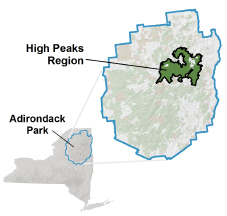
Here is a summary of the rules and regulations regarding hiking and camping in the most popular area of the Adirondacks – the High Peaks Wilderness.
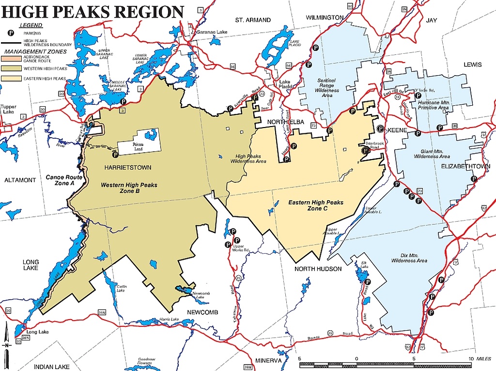
The High Peaks Wilderness has two zones – Eastern and Western. The Eastern Zone is the most heavily used and has the most restrictive rules.
When in doubt, err on the side of caution. Happy Trails.
Courtesy of NYSDEC
Group Size Restrictions
- Day Use – 15 persons max
- Overnight Camping – 8 persons max
- Affiliated Groups – must conform to size restrictions AND must maintain a 1 mile distance of separation at all times
Camping Restrictions
- Tents, tarps, lean-tos, or temporary structures composed of snow permitted
- No Camping at any location above 4,000 feet in elevation
- No Camping above 3,500 feet in elevation but equal to or less than 4,000 feet except at a primitive tent site
- Camping within 150 feet of any trails or water is permitted only at designated sites
Campfire Restrictions
- Eastern High Peaks Zone – NO CAMPFIRES including wood burning stoves and any type of use of wood as fuel
- Western High Peaks Zone – NO CAMPFIRES above 4,000 feet
- Western High Peaks Zone – Campfires permitted 150 feet from any road, trail, spring, stream, pond or other body of water OR at a primitive tent site or lean-to site
Miscellaneous
- Sign-in at ALL trail registers
- Garden Parking (Closed Summer 2019) and Hiker Shuttle Information
- Parking at Heart Lake / ADK Loj
- Eastern High Peaks Zone – requires the use of Bear Resistant Canisters between April 1 – November 30
- Skis or Snowshoes – required when there is snow-cover of 8 inches or more
- No Motorized Equipment or Vehicles
- Have your pet’s vaccination papers
- Eastern High Peaks Zone requires pets to be leashed on trails, at primitive tent sites, at lean-to sites, at elevations above 4,000 feet, or areas where the public congregates
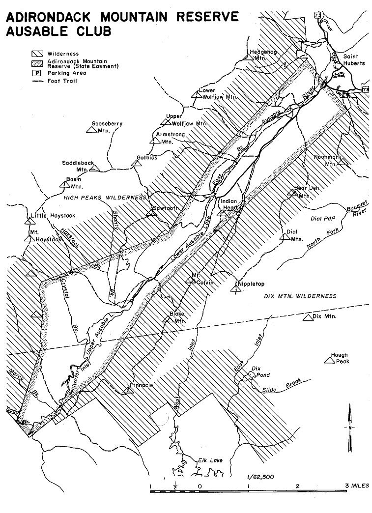
Special Rules – Adirondack Mountain Reserve aka Ausable Club
- Park at the designated lot on Route 73 – St. Huberts
- No Drop-offs at trailhead/gate (.7 mile from parking)
- It’s your right to use this Public Easement, sign-in at the gate
- No Dogs, No Bicycles, No Camping, No Fires
- No Cell Phone usage in public areas
- No Hunting, No Fishing, No Boating, No Swimming
- Stay on the trails, respect No Trespassing signs
- Don’t even pick the flowers
- Follow the Rules, they have armed security
- All other NYS regulations apply
Normally I wouldn’t say, but since you’re reading:
- Use Common Sense and Be Courteous
- Use designated campsites and/or lean-to shelters whenever possible
- Leave No Trace and be a Low-impact Ninja
Please read the regulations, other inquiries: NYSDEC Region 5