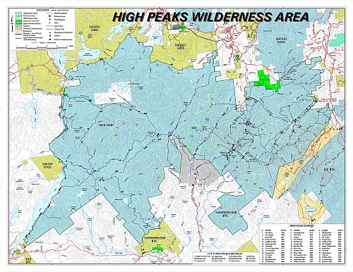
 As we approach Labor Day Weekend, many people are wondering what the status of the backcountry is post-Irene. Simply said, the High Peaks Region is in a bit of a mess and should be avoided. Here is a worthy-list of alternative places to hike this weekend:
Mountain Hikes
- Hurricane Mountain from US-9N only, not from the Hurricane Road/The Crows
- Whiteface Mountain from Whiteface Landing/Connery Pond or Marble Hill/Wilmington
- Baxter Mountain from US-9N or Beede Road (off Route 73)
- Pitchoff Mountain from Route 73
- McKenzie Mountain from Route 86
- Haystack Mountain from Route 86
- Scarface Mountain from the Old Ray Brook Road off Route 86
- Mt. Baker from Moody Pond Road in the Village of Saranac Lake
- Ampersand Mountain off Route 3
- Panther Mountain from Route 3
- Jenkins Mountain from VIC at Paul Smiths off Route 30
- Floodwood Mountain from the Floodwood Road off Route 30
- St.Regis Mountain from Keese Mills Road off Route 30
- Vanderwhacker Mountain from Route 28N
- Goodnow Mountain from 28N
Non-mountain Hikes
- Brewster Peninsula Nature Trails in the Village of Lake Placid
- Bloomingdale Bog from Route 86
- Raquette Falls from Corey’s Road off Route 3
- Deer Pond Loop from Route 30 or Route 3/30
- Fernow Forest-Wawbeek Plantation from Route 30
- VIC at Paul Smiths Trails on Route 30
- Hoffman Notch from the Boreas Road
- Great Camp Sanatanoni from Route 28N
- Adirondack Interpretive Center Trail System on Route 28N
Visit the Adirondack Trail Information web page for current weather forecasts, regulations, safety tips, trail conditions, and more.
(If you need help or have questions, contact @VisitAdks on Twitter, or Visit Adirondacks on FB)
Courtesy of: DEC Region 5


