Adirondack Base Camp header image

Entries Tagged as 'conservation'

DEC Rids Adirondack Pond of Non-Native Fish to Restore Native Brook Trout Fishery

November 13th, 2013 · 1 Comment · Adirondack News

NYSDEC LogoThe New York State Department of Environmental Conservation (DEC) recently completed a major effort to eradicate non-native fish from Lower Sargent Pond in Hamilton County, DEC Regional Director Robert Stegemann announced today. The pond will be stocked with fish next year to reestablish the high quality, naturally reproducing native brook trout fishery that had existed there before its population was depleted due to the presence of the non-native fish.

“Native brook trout populations have been significantly reduced in the Adirondacks and other areas throughout the east, but we are committed to restoring these populations in local waters,” said Director Stegemann. “This tremendous coordinated effort will ensure the continued existence of a natural aquatic community and provide a high quality wilderness fishing experience for anglers.”


Providing a high quality wilderness fishing experience on Lower Sargent Pond promotes Governor Cuomo’s NY Open for Hunting and Fishing Initiative, which has improved recreational activities for in-state and out-of-state sportsmen and sportswomen, and boosted tourism opportunities throughout the state. This initiative includes the streamlining of hunting and fishing licensing along with reduced license fees, improved access for fishing at various sites across the state and increased regional hunting and recreational opportunities.

The eradication of non-native fish, followed by restocking with native brook trout is a key component of DEC’s Brook Trout Restoration Program. DEC is a partner in the Eastern Brook Trout Joint Venture (http://easternbrooktrout.org/), which is working to protect, restore and enhance brook trout populations and habitats across their native range.

For decades Lower Sargent Pond was considered a high quality fishery, which sustained natural reproducing brook trout population. It was one of the most popular fly-in fishing destinations in the Adirondacks, and many anglers would walk the two miles into the pond to fish for brook trout.

Decline of Brook Trout - Map

As the abundance of largemouth bass increased in the pond, the brook trout population severely declined. In 2012, no young brook trout were present; only large, older brook trout that had been hatched before the bass population had grown. The decline in the brook trout population was not due to overfishing. The primary causes were illegal fish stocking and use of bait fish.

The eradication of non-native fish from a water body is known as a “reclamation.” The reclamation procedure is used to return the water to a historic natural aquatic community, provide higher quality fishing opportunities and, where possible, to reintroduce endangered fish species such as round whitefish.

The reclamation of the131-acre Lower Sargent Pond is the largest reclamation in New York State in several decades. A considerable amount of resources and a extensive coordination were needed to complete the reclamation over a five-day period. The effort included the participation of dozens of DEC staff from various regions and programs, and assistance from the State Police Aviation Unit for helicopter transport of personnel, equipment and supplies. There were 37 trips by helicopter during the project, but many workers still had to walk two miles to and from the nearest road carrying equipment and supplies.

Non-native fish, such as bass, yellow perch and golden shiner, negatively impact the native fish communities and ecosystems of Adirondack waters. Non-native fish prey on the eggs and young of native fish. They out compete brook trout and other native fish by consuming large quantities of zooplankton (very small aquatic animals) and other prey food that the native fish feed upon.

It is illegal to move fish from one water body to another without a permit from DEC. The possession or use of fish as bait is prohibited in Lower Sargent Pond and many other trout ponds in the Adirondacks to prevent the introductions of non-native fishes.

Adirondack heritage strain Little Tupper brook trout will be stocked in the pond next year. It is projected that in the next three to five years, Lower Sargent Pond will once again be a high quality wilderness brook trout fishing destination.

Brook trout thrive on a diet of insects and other invertebrates, and grow to large size in ponds that do not have minnows as forage. The current state record brook trout is a 6 pound fish caught in an Adirondack wilderness pond that contains no other fish species. Minnows can become abundant in a pond or lake and compete with brook trout for food – decreasing the brook trout population.

More information on protection of native brook trout, impacts of non-native fish, rotenone and other topics can be found at: Protecting Adirondack Fish.

Tags: ···

Lake Sturgeon Restoration Continues in North Country

October 18th, 2013 · No Comments · Adirondack News

NYSDEC LogoLake sturgeon will again be stocked in North Country waters as part of a restoration program for this threatened fish species, according to Judy Drabicki, Region 6 Director for the New York State Department of Environmental Conservation (DEC). This restoration effort is made possible in collaboration with the U.S. Fish & Wildlife Service (USFWS), the St. Regis Mohawk Tribe (SRMT), the New York Power Authority (NYPA) and the U.S. Geological Survey (USGS).


On October 22, more than 10,000 fingerlings (four month old, 5- to 8-inch long fish) will be released into the St. Lawrence River and its tributaries. Approximately 7,000 lake sturgeon will be stocked in the St. Lawrence River in Ogdensburg at the Greenbelt boat launch off Riverside Ave. The Salmon River, St. Regis River, and Raquette River will receive a portion of the remaining fingerlings, continuing the St. Lawrence River tributary stocking program, which has been ongoing for several years.

The lake sturgeon is one of New York’s largest freshwater fish.

Under the restoration program, eggs were collected from mature fish at the New York Power Authority St Lawrence River Power Dam in Massena this spring. After fertilizing, the eggs were transported to the USFWS fish hatchery in Genoa, Wisconsin, and the hatched fish were nourished until they were large enough to be stocked back into the wild. Some of the fertilized eggs were taken to the DEC Oneida Hatchery for hatching, raising and release into other NY waters.

‘This magnificent fish species was classified as threatened in New York State nearly 40 years ago, but stocking continues to help reverse population declines that occurred earlier this century,” Drabicki said. “Previous stocking efforts in tributaries like these in St. Lawrence County have demonstrated success, with dozens of sturgeon ranging up to 48 inches being observed and some having reached maturity, when they are ready to spawn.”

Lake Sturgeon
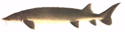
David Stilwell of the USFWS said “One of the Service’s goals is to work towards fully functional and sustainable landscapes. This multi-agency effort to reintroduce lake sturgeon to New York rivers brings us one step closer to restoring the natural heritage of New York waterways. We look forward to working together in partnership on future projects in the St. Lawrence River tributaries.”

Lake sturgeon once flourished in waters along New York’s northern border and provided large commercial harvests near Buffalo. In 1885, harvests totaled 1,800 tons. Prior to the decline in the sturgeon populating, these large fish inhabited all areas of New York’s border waters on the west, north and northeast regions of the state, including Lake Erie, the Niagara River, Lake Ontario, the St. Lawrence River, Lake Champlain and in several St. Lawrence River tributaries up to 60 miles upstream.

Activities to increase lake sturgeon populations include: protection from harvest, hatchery rearing, planning, habitat improvement, stocking of fingerlings, and outreach and education. In order to cover all these activities, DEC is cooperating with our federal partners and the SRMT and NYPA. USFWS and USGS focus on raising the small fish in hatcheries and evaluating their survival and growth toward maturity then everyone is involved in communicating to the public about our efforts and how to protect the fish. The USFWS – New York Field Office helps support the lake sturgeon restoration program through funding provided from the Fish Enhancement, Mitigation, and Research Fund, a settlement reached with the New York Power Authority for the relicensing of the St. Lawrence Power Project.

The additional sturgeon reared at the DEC hatchery at Oneida Lake were stocked in the Genesee River downstream of Rochester and into Cayuga Lake in early October.

Hatchery fingerlings are produced for bodies of water chosen as having the best prospects for restoration. One of the signs of program success has been experienced with mature fish being seen in spawning locations in Oneida Lake and the Oswegatchie River, when they are ready to spawn. In addition, small fish have been collected from Oneida Lake that were naturally spawned.

Inquiries about this threatened fish restoration program and other similar projects can be directed to DEC, Bureau of Fisheries in Watertown, at (315) 785-2263. Additional information on lake sturgeon can be found on DEC’s website at: Lake Sturgeon Fact Sheet.

Tags: ····

DEC Opens Access to New Recreational Opportunities on the Sable Highlands Conservation Easement Lands

October 7th, 2013 · No Comments · Adirondack News

NYSDEC LogoA number of new facilities and access opportunities on the Sable Highlands Conservation Easement Lands (CEL) in Franklin and Clinton counties are now available for public use, New York State Department of Environmental Conservation (DEC) Commissioner Joe Martens announced today.

“DEC is committed to providing abundant, year-round outdoor recreation opportunities on the forest preserve, state forest and conservation easement lands,” said Commissioner Martens. “The new facilities will enhance public use and enjoyment of the conservation easement lands in western Clinton and eastern Franklin counties and will be available for the upcoming fall foliage, hunting and trapping seasons.”

28,000 acres of lands

Access to new recreation opportunities on Sable Highlands CEL further expands Governor Cuomo’s NY Open for Hunting and Fishing Initiative, which has improved recreational activities for in-state and out-of-state sportsmen and sportswomen and to boost tourism opportunities throughout the state. This initiative includes the streamlining of hunting and fishing licensing and reducing license fees, improved access for fishing at various sites across the state and increasing hunting opportunities in various regions.

Sable Highlands - Locator MapUnder Governor Cuomo’s direction, DEC has been working intensely to enhance access to state-managed lands across the state. Their efforts include recently opening 11,600 acres of lands and waters in the Essex Chain Lakes tract in the center of the Adirondacks for the public to enjoy outdoor recreation. This is part of an agreement for the state to acquire 69,000 acres of land formerly owned by the Finch Pruyn Paper Company over five years. Three major tracts of land have been secured under this acquisition to date: the Essex Chain of Lakes, the Indian River tract, and the OK Slip Falls tract.

Conservation easements are used to protect a variety of important natural resources and landscape values, such as water quality, wildlife habitat, sensitive ecosystems, wetlands, scenic areas, agricultural land, working forests and historic sites. The primary function of an easement is to limit or eliminate future development and undesirable land uses on a property, while allowing for continued private ownership and traditional management. Some conservation easements, like the Sable Highlands CEL, allow public access to the protected property.

Sable Highlands - Public Use AreasDEC and its partners have constructed new parking lots, opened some Linear Recreational Corridors (LRC) roadways for motorized use and installed informational kiosks that provide access and enhance the usage of specific public use areas (PUA) in the Sable Highlands CEL. Linear Recreation Corridors are roads and trails on the property that travel through private lease areas as a means to provide ingress and egress to and from PUAs. The LRCs will have posted signs and be managed in a manner that best facilitates public access while ensuring that public use has a minimal effect on private club members’ enjoyment of their posting leases.

Recent logging activities and the abundance of water resources provide high quality game habitat sought by hunters and trappers. The forest consists mainly of hardwood tree species that will be changing colors, which will offer opportunities for pleasant nature viewing walks, biking or leisurely drives during the fall foliage season.

Figure 8 Public Use Area
A new 6-vehicle parking area has been constructed on the Blair Kilns Road in the Town of Bellmont, Franklin County, providing access for recreational users to 3,900-acre Figure 8 PUA.

Cold Brook Public Use Area
A new 6-vehicle parking area has been constructed on the Standish Road in the Town of Saranac, Clinton County, providing access for recreational users to the 2,500-acre Cold Brook PUA.

Informational kiosks and register boxes at each parking area provide information for people using these lands. Access beyond the parking areas is by foot or mountain bike only. DEC plans to provide additional opportunities for public motorized access in the future.

D&H Road Linear Recreation Corridor
The 6.5-mile D&H Road is open to motor vehicles and mountain bikes during the summer and fall. It will be closed in the winter and during mud season. The road can be used year round by hikers, skiers and snowshoers as conditions warrant. The road connects Franklin County Route 26 near the hamlet of Loon Lake in the Town of Franklin with the Wolf Pond Road just east of the hamlet of Mountain View in the Town of Bellmont.

The road is for motorized thru-traffic only as there are no parking areas or pull-offs along the road. The 3,900-acre Plumadore-Inman PUA abuts the road on the west along much of the road. The public should be aware that a number of private landowners and privately licensed recreation clubs have exclusive use on other properties along the road. Trespassing on those lands is prohibited.

Barnes Pond Road Linear Recreation Corridor
The 3.9- mile Barnes Pond Road is open to motor vehicles during the fall hunting seasons. It is recommended that only high clearance SUVs and trucks use the road. The road can be accessed from a parking area on the True Brook Road in the Town of Saranac, Clinton County.

Hunters and others can use the road to access the 3,700-acre Barnes Pond PUA. Wheeled camping equipment up to 20 feet in length, such as pop-up campers, truck campers and tow-behind camper trailers, can be used at six fully accessible designated campsites along the road. At this time, motor vehicle use on the road is allowed from October 4 through the end of the Northern Zone Big Game Rifle Season only, weather and road conditions permitting.

DEC Region 5 operations staff and members of the Student Conservation Association (SCA) Adirondack Program worked for more than three years to construct the facilities. Construction would not have been possible without the cooperation and assistance of the landowner, The Forestland Group of Chapel Hill, North Carolina.

The new facilities complement a number of existing facilities and improvements previously constructed on the property by DEC, including:

  • Fishhole Pond Fishing Access Site – Town of Franklin, Franklin County
  • Grass Pond Fishing Access Site – Town of Franklin, Franklin County
  • Two designated campsites, accessible by the public on foot or by mountain bike, in the 3,900-acre Plumadore-Inman PUA- Town of Franklin, Franklin County
  • One designated campsite and a parking area with an informational kiosk, enhancing access to the 415-acre Saranac River PUA- Town of Franklin, Franklin County

DEC forest rangers and environmental conservation officers will conduct regular patrols of these locations and nearby conservation easement lands to educating users, enforce environmental laws and regulations and ensure the proper and safe use of the area.

Parking areas and access points are marked with DEC signs, informational kiosks, maps and public recreation usage guidelines specific to each PUA.

Food and gas for those using the Sable Highlands CEL can be easily found in the nearby communities of Vermontville, Brainardsville and Mountain View in Franklin County and Redford, Saranac, Merrill and Dannemora in Clinton County. The closest available lodging opportunities are available in Saranac Lake, Malone and Plattsburgh, while a wide variety of developed and primitive camping opportunities and seasonal rental properties are available in-season within a 25-mile radius of the PUAs.

More information, including descriptions of the PUAs and LRCs, directions, usage guidelines and maps can be found on the DEC Sable Highlands CEL webpage at Sable Highlands Conservation Easement or by contacting the DEC Division of Lands and Forests Region 5 office at (518) 897-1291.

The Sable Highlands CEL include more than 28,000 acres of lands distributed over 14 PUAs, all of which are open and available for public access and recreation in accordance with the April 2009 Interim Recreation Management Plan (IRMP). More than 56,000 acres of the Sable Highlands CEL is leased by the landowner to hunting, fishing and recreation clubs for their exclusive private use.

Tags: ····