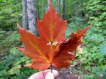
I got a request for some locations for a fall foliage video shoot which I may as well blog. Here’s my 5-minute response:
On or around 9/15 is still pretty early, but there will be some trees beginning to change. If you’re looking to “Kick-off” Foliage Season by finding the First Signs of Autumn in the Adirondacks, then I think it is completely doable.
Best chance of leaf change will be in our Northern area and higher elevations. I asked about format because I was not aware of Xxxxxx doing any broadcast stuff, but video content I totally understand. We can do anything from a simple shot at a conveniently accessible location to paddling or hiking a High Peak. I’ve compiled a short list of possible locations which might suit – most around the Lake Placid area. This shouldn’t exclude any place along the way or in between. If you/they have any specific places or type of place, please let me know.
#1 ADK Park Visitor Interpretive Center – Paul Smiths
Located just north of Paul Smiths College, the VIC features a staffed Nature Center, hiking trails, and a good sampling of Adirondack scenery. Easy access. We could get a naturalist to offer information and “color”. There are Adirondack Lean-to’s on site.
Paul Smith’s College VIC
#2 Whiteface Mountain Veterans Memorial Highway
Pending weather conditions, a drive from Wilmington up to the top of Whiteface Mt via the Memorial Highway will likely feature the full range of possible foliage conditions. Gondola rides on the other side at the ski area are available Fri -Sun only, but if they arrive early it would be an option. Any of the other Olympic facilities are also possible with prior notice.
Whiteface Mt – Memorial Highway
#3 High Falls Gorge – Wilmington Notch
Located between Wilmington (Whiteface Mt) and Lake Placid, High Falls Gorge and Wilmington Notch offers some dramatic landscape. There are both waterfalls and flat water along the Ausable River with cliffs on both sides.
High Falls Gorge
#4 Wild Center
The Natural History Museum of the Adirondacks, located in Tupper Lake. This important new attraction may also serve as a good backdrop. In addition to the museum facility, there is a trail system and river environment easily accessible.
Wild Center
#5 Adirondack Loj – Heart Lake Trailhead
The Adirondack Loj, operated by the Adirondack Mountain Club, is located just outside of Lake Placid. Important both historically and as one of the principal trailheads into the High Peaks. The location is has both water (Heart Lake) and a short hike with views (Mt. Jo). There is also the High Peaks Information Center with ADK Club and DEC staff.
Adirondack Loj
#6 Adirondack Museum
Located in Blue Mountain Lake, the Adirondack Museum is another important anchor attraction. During that time they continue to have several special exhibits and they are just getting ready for the Adirondack Antiques Weekend. This location is the furthest south, so color will be just beginning at the upper elevations.
Adirondack Museum